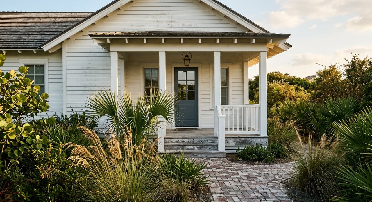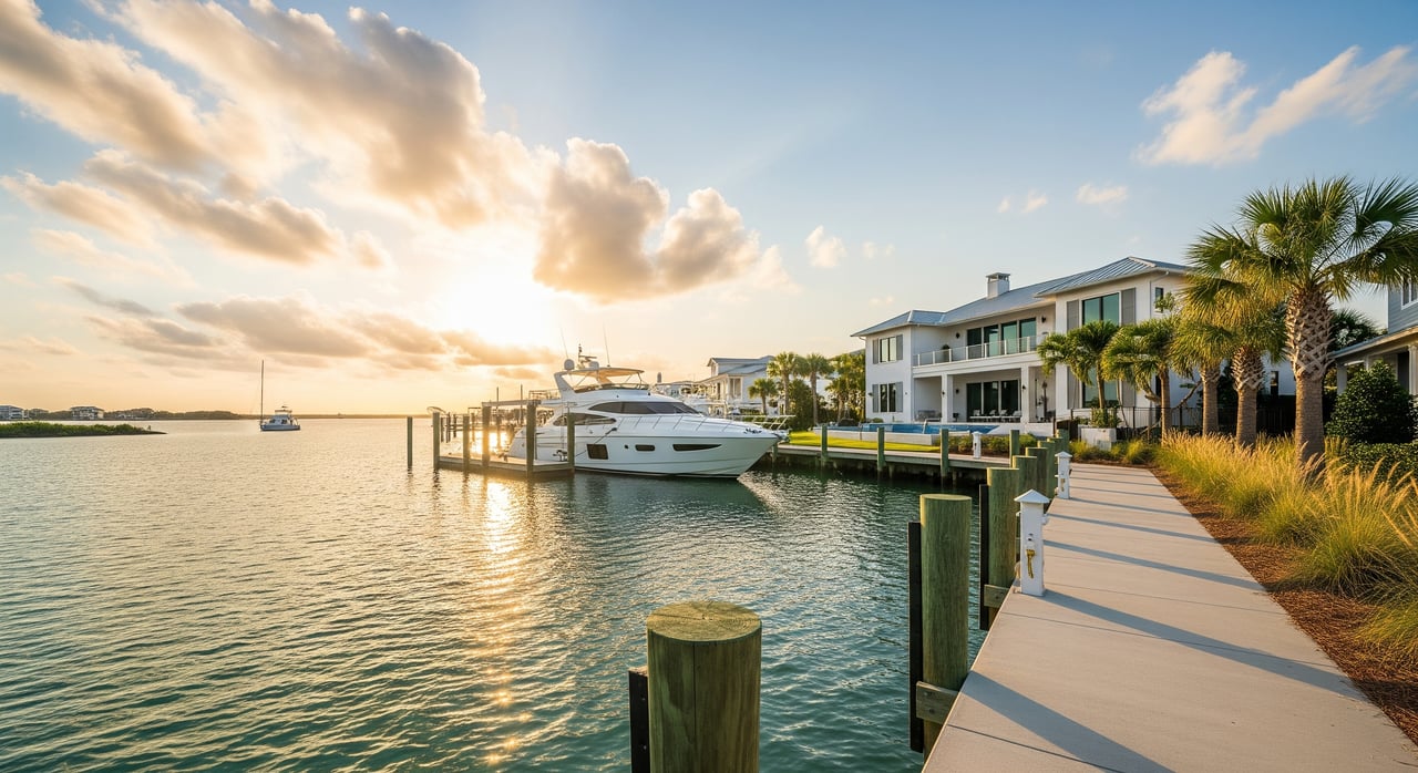
Thinking about a boat-ready home on Destin Harbor? Deep-water access can make or break your experience. You want confidence that your dock can handle your vessel at low tide and that you can reach the Gulf without surprises. In this guide, you will learn what deep-water access really means in Destin Harbor, what to verify before you buy or sell, who to contact, and how to protect your investment. Let’s dive in.
Deep water on Destin Harbor
“Deep-water access” is practical, not a single number. It means your dock or marina provides reliable, navigable water depth and clearance for your specific boat under typical low-tide and seasonal conditions, with a smart safety margin. On Destin Harbor, you also need to consider travel through East Pass to the Gulf, nearby traffic patterns, and how storms can shift sand.
There is no universal threshold that fits every boat. A center console, sportfish, and sailing yacht all have different drafts and air draft needs. The right approach is to evaluate the vessel, the charted depths at the correct datum, and local conditions together.
Harbor factors that matter
Channel maintenance
Destin Harbor connects to the Gulf through East Pass. Federal navigation channels and the inlet are typically maintained by the U.S. Army Corps of Engineers. Private basins and slips may be maintained by owners, HOAs, or local authorities. Shoaling is common in inlets and harbors, and dredging schedules change over time, so current maintenance directly affects your access.
Tides and chart datum
Depths on nautical charts are shown relative to a specific datum, often Mean Lower Low Water. When you compare a boat’s draft to a charted depth, you must use the correct datum and add a conservative operating margin. Local tidal range and weather can temporarily change effective depth. Very low tides and post-storm conditions can expose shoals you might not expect.
Shoaling and storms
Hurricanes, tropical storms, and seasonal currents can rapidly shift sand, especially near East Pass and along harbor edges. Long-term coastal processes can alter channels over years and require repeat dredging. After major weather events, it is wise to confirm recent soundings and ask about temporary hazard notices.
Dock design and clearance
How your dock is built matters. Fixed versus floating docks, piling spacing, lift capacity and height, and the presence of floating fingers all influence what boats can tie up safely. Vertical clearance is also critical. While Destin Harbor itself has limited bridge constraints, you should still confirm air draft limitations for antennas, outriggers, or masts near your route.
Regulations and permits to know
Several agencies oversee navigation, construction, and environmental protection. Before you build, modify a dock, dredge, or buy a property with existing structures, confirm the status with the right offices.
- Federal
- U.S. Army Corps of Engineers, Mobile District: Maintains federal channels and issues Section 10/404 permits for docks, lifts, dredging, and fill in navigable waters and wetlands.
- NOAA: Provides nautical charts, bathymetry, and tide and current predictions you will use to verify depths and plan safe passage.
- U.S. Coast Guard: Manages aids to navigation and enforces harbor safety rules.
- State
- Florida Department of Environmental Protection: Oversees environmental and some coastal construction permits.
- Florida Fish and Wildlife Conservation Commission: Regulates boating rules, vessel registration, and certain mooring and anchoring policies.
- Local
- City of Destin and Okaloosa County: Handle local pier and dock permits, shoreline development rules, floodplain permitting, and Harbor Master or Marine Patrol guidelines.
- Other considerations
- FEMA and the National Flood Insurance Program: Drive flood zone designations and insurance requirements that affect ownership costs.
- Environmental protections: Seagrass and critical habitats can restrict dredging or require mitigation.
- Clean boating and discharge rules: Pump-out use and discharge prohibitions apply.
Buyer checklist: what to verify
Before you write an offer on a Destin Harbor property with a dock or slip, gather the right documents and confirm on-the-water realities.
Documents and data
- Most recent nautical chart for Destin Harbor and any available bathymetric survey for the basin or slip.
- U.S. Army Corps of Engineers reports on federal channel depths and any active or recent dredging near East Pass.
- Depth logs or measurements from the Harbor Master or local marinas.
- Title survey showing the mean high-water line and any riparian or dredging easements.
- Dock and lift permit history, repair records, and any open code issues.
- Flood elevation certificate and current FEMA flood zone for the parcel.
- Marine survey of the dock and, if access is critical, an underwater or bathymetric survey taken at low tide.
On-site inspection
- Measured depth at the dock at the lowest expected tide or certified bathymetry, plus typical tidal variation.
- Utilities at the slip, including shore power capacity and water. Confirm any nearby fuel availability.
- Physical fit: slip length and width, piling spacing, lift rating and height, turning room, and any low-clearance pinch points.
- Signs of shoaling near the slip entrance or a history of private dredging needs.
- Presence and visibility of navigational aids, marked channels, and local hazard markers.
Legal, financial, and maintenance
- Who maintains what: private owner, HOA, marina, or special district for dredging and structural work.
- Permit status: unpermitted structures may require costly remediation and can complicate closing.
- Insurance needs: flood based on FEMA maps and wind or hurricane coverage typical for coastal properties.
- Long-term costs: seawall repair, dock replacement cycles, periodic dredging, and any seagrass mitigation obligations.
Match your boat to the access
Start with the vessel you own or plan to buy and work backward to the dock or slip.
- Vessel draft vs. charted depth: Compare the boat’s draft to the depth at the correct chart datum and add a safety buffer to avoid grounding.
- Air draft and clearance: Confirm there are no low-clearance obstacles along your route for masts, outriggers, or radar.
- Maneuverability: Ensure there is adequate turning basin and that you can safely navigate near commercial traffic and fishing fleets.
- Lift and slip specs: Verify lift capacity and beam, and ensure the slip length fits your hull with room to spare.
Costs, risk, and insurance
Ownership along Destin Harbor can include shared or private responsibilities. Federal dredging typically covers federal channels, while private basins, canals, or slips are often the responsibility of owners or HOAs unless a local district handles it. Review deed restrictions, HOA documents, and local ordinances to confirm who pays for dredging and when.
Flood insurance is commonly required based on FEMA flood zone designations. Wind and hurricane coverage often comes with higher coastal deductibles. Budget for expected seawall and dock life cycles, periodic inspection, and potential post-storm repairs. If a property relies on private dredging to keep access viable, price that into your long-term plan.
For sellers: prep your file
Buyers of deep-water properties value clarity. You can strengthen your position and speed up due diligence by organizing a clean package.
- Dock and lift permits with drawings, plus any USACE authorizations.
- Recent repairs, maintenance records, and contractor warranties.
- Any dredging logs, soundings, or bathymetric surveys, and who is responsible for future dredging.
- Title survey with the mean high-water line, any easements, and riparian rights information.
- Flood elevation certificate and current insurance details for context.
- A simple summary sheet that states slip dimensions, lift capacity, utility service, and the typical route to East Pass.
Next steps on Destin Harbor
If deep-water access is essential to your boating lifestyle, take a methodical path. Request the latest chart and any recent bathymetric data for the property. Ask for dock permits, repairs, and dredging records. Have a qualified marine surveyor inspect the dock and, if access is critical to value, commission a low-tide underwater survey.
Contact the Destin Harbor Master and local permitting offices in Okaloosa County or the City of Destin to confirm permit status and learn about any planned dredging. Review FEMA flood maps and secure a flood elevation certificate. Speak with an insurance professional about coastal coverage specifics before you finalize an offer.
When you are ready to evaluate options or prepare your listing, connect with a local team that knows the boating and investment sides of the market. For a tailored plan and discreet guidance on Destin Harbor properties, reach out to Katie Atwater and Mike Henderson.
FAQs
What does “deep-water access” mean in Destin Harbor?
- It means the dock or marina reliably provides enough depth and clearance for your specific vessel at the lowest expected tide with an appropriate safety margin.
Who is responsible for dredging near a private slip?
- Federal dredging typically covers federal channels, while private basins or slips are usually the responsibility of owners or HOAs unless a local district provides that service.
Do docks and lifts on Destin Harbor require permits?
- Many docks and lifts need local and state permits, and USACE authorization if in navigable waters or wetlands; unpermitted structures can be costly to fix.
Does deep-water access guarantee quick Gulf access via East Pass?
- Not always, because you still need adequate depth through the harbor and inlet at low tide and must account for traffic and conditions; verify the route for your vessel.
How do storms affect deep-water access on Destin Harbor?
- Hurricanes and tropical storms can cause shoaling, damage docks, and shift aids to navigation; access often depends on post-storm dredging and repairs.