Trying to choose between waking up with your toes in the sand or enjoying wide Gulf views at a better price point? On 30A West in Walton County, both options are stunning, yet they live very differently and carry different costs, risks, and resale dynamics. If you want a second home or an income property that performs, it helps to compare what matters most to you.
In this guide, you will learn the real differences between gulf-front and gulf-view, how each impacts lifestyle, insurance and maintenance, rental income, and resale value, plus the key steps to make a confident choice. Let’s dive in.
What gulf-front means here
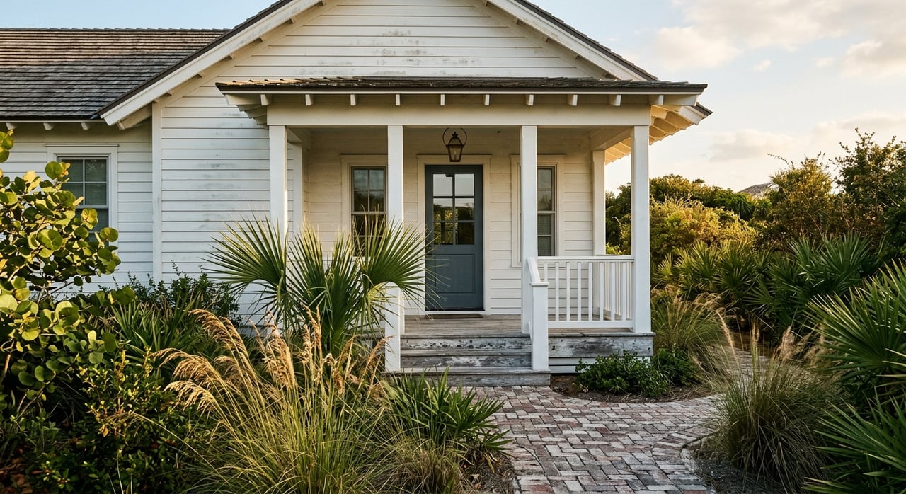
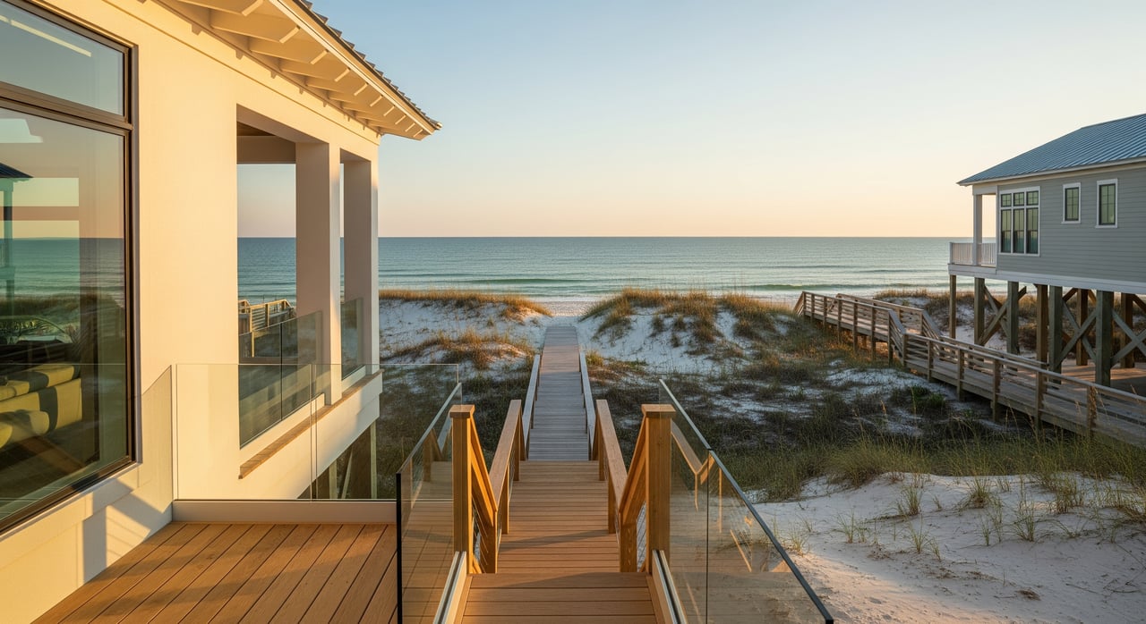
Gulf-front means your parcel touches the shoreline and you have direct private or deeded beach access with no properties between you and the water. Along 30A West, that usually looks like a home near the frontal dune with immediate sand access from your yard or a short private boardwalk. Builders often orient these homes to maximize direct beach access and views.
The appeal is clear. You get the shortest path to the water, unobstructed vistas, and a lifestyle that feels private, even when nearby public access points bring visitors to the shoreline.
What gulf-view means here
Gulf-view means you can see the Gulf from the home or lot, yet you are not directly on the beach. There may be a street, dune line, or neighboring lots between you and the water. On 30A West, many gulf-view properties sit one or more lots back or use elevation, decks, or rooftop spaces to capture sightlines over vegetation or neighboring roofs.
You still enjoy the scenery, often at a lower acquisition cost, with less direct exposure to salt, wind and surge.
Lifestyle tradeoffs that matter
- Access and ease: Gulf-front gives immediate beach access. Gulf-view usually means a short walk to a community crossover or a public access point.
- Privacy and traffic: Public access locations can affect how private a gulf-front property feels. Use local maps to see where walkovers and parking are located so you understand peak-use patterns.
- Outdoor living: Gulf-front yards and decks connect straight to sand via stairs or a boardwalk. Gulf-view homes may trade sand-in-your-yard convenience for quieter outdoor spaces and less salt spray.
- Elevation and stairs: Setbacks and dune height influence how many stairs a gulf-front home may need for access. Gulf-view homes often sit at slightly higher elevations or farther back from the dune, which can change everyday convenience.
Cost, value, and resale
Gulf-front properties typically sell at a premium because of scarcity and direct access. Gulf-view homes offer the sights at a lower price, which can open more choices within a budget. The exact premium varies by block, elevation, condition, and market cycle. The smartest move is to work from immediate neighborhood comps and adjust for view, access, and condition.
For resale, gulf-front listings attract buyers seeking immediate beach access and high-end amenities. Gulf-view properties appeal to buyers who value coastal living with a lower entry price and potentially lower carrying costs.
If you want to research parcel history and assessed values, you can review county records through the Walton County Property Appraiser’s searchable database, then compare with fresh MLS comps for a current picture of value.
Rental income snapshot
If short-term rental income matters, gulf-front properties often command higher average daily rates and strong peak season occupancy because of premium photos, immediate access, and a “bucket list” guest experience. That said, gulf-front units also tend to carry higher cleaning, upkeep, and insurance costs.
Gulf-view properties typically earn lower nightly rates. In some cases they can deliver competitive returns on investment if the purchase price is substantially lower. Ask for street-level performance data from local rental managers and review ADR and occupancy trends before you buy.
Insurance and carrying costs
Insurance is a key difference. Many gulf-front homes fall within higher risk FEMA flood zones such as V, VE, or AE. Lenders usually require flood insurance if a property is in a Special Flood Hazard Area. Always verify the current flood zone for a specific address using the FEMA Flood Map Service Center. Elevation certificates and your home’s base flood elevation heavily influence premiums.
Coastal wind and hurricane exposure also shape costs. The Florida Building Code sets wind load and elevation standards for coastal construction, and insurers may require or reward wind mitigation features like impact-rated windows and doors.
Florida’s property insurance market continues to evolve. For statewide insurance updates and consumer guidance, review the Florida Office of Insurance Regulation. Get multiple quotes for both NFIP and private flood coverage, and ask for sample deductibles for named storms.
Helpful links for due diligence:
- Check flood zones: the FEMA Flood Map Service Center
- Review statewide insurance context: the Florida Office of Insurance Regulation
- Building standards reference: the Florida Building Code site
Permits, dunes, and setbacks
Beach construction sits under both state and county rules. Work near the dune or along the beach often requires permits and must respect the Coastal Construction Control Line. Walton County also has local land development and dune crossover rules that protect vegetation and manage access.
For guidance, start with county permitting and planning resources on the Walton County website and state coastal programs via the Florida Department of Environmental Protection. A clean permitting history and clear records of past dune or shoreline work support both buyer confidence and insurability.
Storm and shoreline risk
Storm surge, sea level rise, and erosion are part of coastal ownership. You can review long-term shoreline considerations with the NOAA Sea Level Rise Viewer and monitor active tropical systems through the National Hurricane Center. In addition to checking flood maps, ask for elevation certificates, wind mitigation reports, and any history of prior claims.
Beach access and privacy
Beach width, public access points, and crossover locations shape daily life at a gulf-front or gulf-view property. To preview how an area functions during peak months, explore visitor maps and public access listings on Visit South Walton. Walk the block in person, then revisit at different times of day and on a busy weekend when possible.
How to decide for your goals
Use this simple framework to compare two homes on the same street:
- Clarify use: primary, second home, or short-term rental. Your use drives acceptable carrying costs and desired finishes.
- Quantify the premium: pull recent comps within the same micro-area, then adjust for view, direct access, elevation, and condition.
- Model the income: ask for rental histories and create a pro forma for ADR, occupancy, fees, and owner use.
- Price the risk: confirm flood zone, get an elevation certificate, and gather two to three flood and wind quotes.
- Weigh maintenance: inspect exterior materials, decks and railings, and mechanicals for salt and wind exposure.
- Sense the setting: map public access points and parking, then assess privacy, noise, and guest flow.
What to gather before you write an offer
- Elevation certificate and current flood zone from the FEMA Flood Map Service Center
- Two to three insurance quotes for flood and wind coverage
- Permit history, including any dune crossover or shoreline work from Walton County
- Rental history or third-party projections for ADR and occupancy
- HOA or association rules that affect rentals and beach access
- Recent neighborhood comps with adjustments for view and access
- Parcel records and prior assessments via the Walton County Property Appraiser
How Atwater | Henderson helps
You deserve advice that balances coastal lifestyle with sound numbers. We combine on-the-ground 30A expertise with data-backed comps, rental performance analysis, and hands-on listing and design guidance. Whether you choose gulf-front or gulf-view on 30A West, we help you quantify the premium, understand insurance and permitting, and position your property for enjoyment and resale.
Ready to compare addresses with clarity and confidence? Connect with Katie Atwater and Mike Henderson for a private consultation.
FAQs
What is the difference between gulf-front and gulf-view on 30A West?
- Gulf-front has direct beach access with no properties between you and the water. Gulf-view offers Gulf sightlines from the home but sits off the beach, often across a street, dune, or neighboring lot.
How much more does gulf-front cost compared to gulf-view near Point Washington?
- Gulf-front usually carries a premium due to scarcity and direct access. The size of the premium depends on exact location, elevation, condition, and market cycle, so use immediate neighborhood comps for precision.
Do I need flood insurance for a gulf-view home in Walton County?
- Lenders typically require flood insurance if a property lies in a FEMA Special Flood Hazard Area. Confirm your flood zone at the FEMA Flood Map Service Center and request an elevation certificate to get accurate quotes.
Are gulf-front homes a better investment than gulf-view for short-term rentals?
- Gulf-front often achieves higher nightly rates and strong peak season occupancy, but operating costs and insurance can be higher. Gulf-view may deliver competitive returns if the purchase price is much lower, so run a full pro forma.
How do I verify beach access rights for a home on 30A West?
- Review the deed and plat for access easements, check association rules that govern crossovers, and confirm public access locations through Walton County records and visitor maps like Visit South Walton.
What permits matter if I plan to renovate a beachfront home?
- Projects near the dune often need county approvals and may require state reviews related to the Coastal Construction Control Line. Start with Walton County and the Florida Department of Environmental Protection for guidance.
Where can I check building standards and storm information for this area?
- Refer to the Florida Building Code for construction standards, track storms at the National Hurricane Center, and review long-term shoreline considerations using the NOAA Sea Level Rise Viewer.